Thursday, July 25, 2013

We Made It!

A loud thunder clap at midnight snapped me out of a sound sleep. I looked out the hotel window and it was pouring! I looked down at the street and it was a river from curb to curb and flowing fast. The water was flowing up and over the wheel rims of our bikes parked in front of the hotel. It was quite a sight so i got my GoPro and recorded it. I will attach it later. The news said it rained 2.46 inches in Silver City overnight. I thought of Bob who was up in the Gila camping. He probably wished he would have opted for a hotel!

We planned an early start but at 6am it was still raining. This is the weather radar map of the storm above Silver City.
We waited an hour and once it started to lighten up, we took off.
We crossed the CD for one last time in a flat area just south of Hachita.

At 10am we arrived at Antelope Wells and the US/Mexico border. Here are some pics and a video.


The border agents were super nice. They congratulated us, took pictures of us at the crossing, and gave us an ice cream! The border agents in Blaine could learn some things from these guys. 
They pointed out a new border structure built at a cost of $20 million years ago and yet sat empty due to various ongoing issues. The biggest one is they can't get enough electricity to the building. At the same time, they've been waiting 2 years to get a broken door window, held together with duct tape, replaced. The govt can't find the $200 in the budget. Insane.
After all the pics, hugs, and congratulations,  we headed back up to the 10 to meet my brother, Dave. Dave brought a trailer to carry the bikes back the 4hrs to Phoenix. We were super happy to see him.

We did it! We traveled the entire length of the Great Divide Mountain Bike Route, 850 miles on mountain bikes to Jackson, Wyoming and the rest of the way on motorbikes. We covered over 2,500 miles. We've seen some amazing country and met lots of interesting people. We've had ourselves quite the adventure and created some unforgettable memories. The best parts of our lives are the experiences we accumulate and the memories they become. And for me and Doug, this trip was a treasure!

Thanks for following along.
  
 We made it!
 
Dave met us and brought a trailer to haul our bikes back

Wednesday, July 24, 2013

Mother Nature Finally Got Us

A 12:30 am, while camped next to the river at Gila Hot Springs, we were awakened by a loud crackling and a big boom. Thru our tents we could see the sky flash white and more crackles and booms followed. Then slowly at first, the rain started. Soon the sky let loose and it poured. Parts of my tent began to leak. I hoped the river wasn't going to rise and sweep us away. But it didn't last long. Still, when we got up, everything was very wet!

First order of the day...go for a soak in the hot springs.  I completely stripped down and walked over to one closest to the river. Ah....

We tried to dry out our stuff as best we could, packed up, and headed 40 miles to Silver City.
First stop Javalinas (pretty clever name for a coffee shop, eh?) for a latte and muffin. Just around the corner is the historic Palace Hotel. We decided it would be appropriate to stay somewhere 'palatial' on our last night on the GDMBR. 

It was a lazy afternoon.  We lunched at Vicky's and toured historic downtown.
When we returned to the hotel we ran into my brother Dave's friend Bob, who was just starting his GDMBR motorcycle trip heading north. We gave him our best advice, shared some maps, and had dinner at Jaliscos with him. He then left us to get a campsite before it got dark. Good luck, Bob. Be safe!

Both of us received flash flood emergency warning texts to our phones. I'm glad our route tomorrow is all on pavement and we are in a hotel tonight. 

We will start at 6am tomorrow. Only 125 miles to Antelope Wells,  the terminus of our journey.  I'm excited to get there!

Tire Wear

This is Doug's rear tire after 1719 miles. I think we need a new one.

Wow! Beyond my expectations NM!

Just when I had written New Mexico off, she surprised me with one of the most beautiful days of the trip.

We decided to get up early today and beat the afternoon thunderstorms storms and heat. It was hot and arid yesterday with sporadic thunderstorms. We expected more of the same.  And since our path was remote, we wanted to try to get through it and avoid a messy, rain plagued surface.

I sensed the finish, and was anxious to get there.  Two more days of 255 miles and 125 miles.

We planned to leave around 5am, but it was still dark then. The days are shorter than they were when we left on June 22, and we are over 2000 miles farther south.  We had to wait until 6am to get some light. We left at 6:45.

The cool morning air penetated our mesh jackets. It was brisk. First stop: Pie Town.

The residual effects of yesterday's rain made the dirt road a little slippery. You had to pay close attention and avoid the muddy parts.

It was only 70 miles to Pie Town.  We were there by 8:30.  We, of course,  stopped and had some pie - freshly made that morning and still warm. Mmmmm.

We asked about the three options for gas: Quemado to the west; Datil to the east; and Old Horse Springs farther down the road off the 12. Datil was the recommendation from the locals - 22 miles down and the same back. I decided to empty the gas can into Doug's bike and then have him wait for me while I went for gas, since I had a bigger tank and range. Just as we were finishing our pie, the cook overheard our questions and asked what octane we took. Well, we take high octane but can run lower so I said I'll take whatever you have. So for $10 we got 2 gallons, and now had enough to get us the 185 miles to the next station in Silver City. Whew! That was a relief!

The route from Pie Town was surprisingly scenic.  We went thru forests of huge Ponderosa Pines and high lush green valleys. There were small canyons with interesting rock formations and grand vistas around every corner.  We saw elk herds and herds of proghorn antelope. The riding was fun with just the right amount of challenge. It might have been the most delightful section of the whole route. We kept close to the CD, and by the end of the day crossed it 11 times!

It was a long section, so I had to concentrate on the navigation and make no mistakes.  It was remote country,  and we saw little activity. We had limited fuel with little room for a mistake.

The Android app Maverick came in handy a couple of times. I have a gpx file of the route saved on my phone and when I bring it up the app shows me where I am relative to the route. It has saved me more than once and is a nice confirmation that I'm correctly on course.

Evidence of recent heavy rains was abundant.  We got some pictures of the residual of a flash flood down one of the canyons. Scary stuff!

We stopped briefly at Rocky Canyon campground to snack and rest. While there, a thunderstorm caught us and we sought shelter in the outhouse.  :-)  It was brief and not too bad.

When we finally exited the wilderness and hit the paved 35, a euphoric rush came over me. We had made it! We had just completed the last bit of challenge.  From here it will be smooth sailing to the finish in Antelope Wells.

We had a cushion on time, so decided to head off route to Gila Hot Springs and spend the night. We will descend the 45 miles to Silver City after visiting some ancient cave dwellings in the morning.

It was an excellent day! 45 miles to Silver City, and then 125 to the border Thursday morning. Dave will pick us up.

Monday, July 22, 2013

Back on Route - Ojo Caliente to Grants

We slept in to 7:30 this morning. The beds were super comfy and we were awake late watching the western classic, Shane, filmed in the Tetons. We knew we had an easy day planned and felt no need to rush.
30 miles down the 285 and then up the 84 rejoined us on the route at Abiquiu. We had studied the route for today from Abiquiu to Cuba and the description was intimidating - rough and rocky. We figured the rain may have exacerbated the situation.   After yesterday's tough ride we decided to opt for the easier route and take the paved 96 into Cuba.
In Cuba while filling up at the gas station I asked a guy for a nice place to lunch. He pointed us to El Brunos. We chatted for a while and found out he is the fire chief, a veteran who works with Wounded Warriors, and has a 5,000 acre ranch with a guest house and 17 miles of trails. He invited us to come up and stay! If it wasn't so close to the end of our journey I would have taken him up on the offer. Maybe in the future? Thanks James Sanchez!
From Cuba we took the Chaco alternate route on the 197 then the 509. We expected it to be more interesting. It was quite barren with not much to see.
We passed a mtb'er about 15 miles from Grant. It appears he too was leery of the rocky dirt and effects of the recent rain on the dirt roads.
We pulled into Grant (not much here either), grabbed a hotel, and got horizontal.  It is nice to have a short day.
Tomorrow we head to Pie Town and maybe Silver City. We need to figure out if our full tanks and a 2 gallon spare will take us 253 miles. If not, we will need another plan.

Thanks for all the emails

I've received lots of emails since we began our adventure.  I though I'd share my favorites.  So without permission...:
_________________

okay - i am all caught up - you is crazy man - the water crossing was awesome... ;-) ...hope all is well and look forward to next post.

- Nate Loman
__________________

Hi DJ.  I've been following your adventures and reading your blog posts. I must admit, I even teared up when reading about the agonizing decision. But the coolest and most inspirational thing is how you handled it.  Take a little time to relax and clear your mind.  Think it over. Then come up with such a great solution to carry on and finish, just using a different means.  Brilliant!  What a great adventure you've had.  Nicely done!

- Kent Wheiler
_____________________

Motorcycles?!!?

This adventure keeps getting better and better!

Your post made my morning. 

Keep at it! 

Best wishes,

- Linsey Corbin
_____________________

I love this!! So cool. Great you stepped out of your comfort zone re decision making!Keep having fun. No crashes pls.

- Urs
_______________________

You guys rock! Not only are you conquering the great divide, but I can tell you guys are having way too much fun! Inspiring and very cool! Thanks, for the posts!

- Emily
_______________________

You are cool DJ!  You are very cool!  What an awesome time you are having. Good on you for making the most of the  dodgy Achilles. 

- Tom Landon-Smith
______________________

Well played boys!  Well played.  Whodathunk?  Way to "Quitchyerquitchen" Thanks for the alert - I'll stay tuned.

- Ken Dailey
________________________

Into New Mexico!

Sunday we woke up early, packed our camping gear (we're getting good at it), and road 15 miles into Del Norte. While filling our tanks we asked an old timer where we should eat breakfast. He told us Boogies, which is owned by a guy who used to pick his nose when he was a kid and the nickname stuck. Funny. Good breakfast.
Earlier we bought a 2-gallon gas tank for the longer stretches between gas stations in New Mexico. We thought we might need it so filled it up today.
After breakfast we began the climb to the highest point of our trip, Indiana Pass at 11,910 feet. It was beautiful up high. The open meadows were green and lush against the rich blue sky. We were lucky to hit this section on a Sunday and thus avoided all truck traffic from the big mine at Summitville. Doug of course stopped and took lots of pictures.  We will update the blog later with them when we get access to a computer.
The road wasn't bad but we did have to gear down on some of the tight and narrow turns on the way down.
The water in the rivers here are full of natural chemicals you wouldn't want to drink. (Can't remember the names but pretty sure one was arsenic).
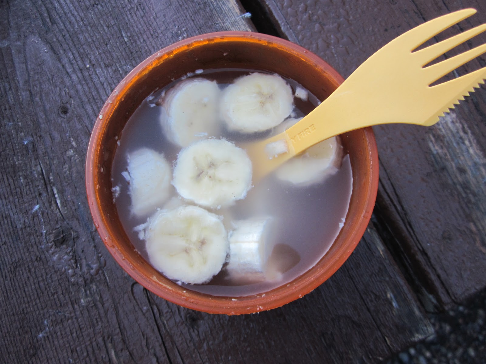
At the base we came to the scrappy little town of Platoro. We stopped and shared a peach cobbler. Bleck! It was terrible.
To get to Horca at paved highway 17 we had to ride across 23 miles of washboard road. We kept searching for the smoothest bit, but got rattled and pounded by this dirt road.
From Horca we climbed smooth pavement up to Manga Pass at 10,200 ft, and past the Toltec Scenic Railway and a hugely bloated dead cow.
Four miles the other side of the pass we turned left on the 117, a rough and rocky narrow road that lead us into The Cruces Basin Wilderness and the State of New Mexico.
The 117 turned into the 87. It was rough going and I thought it would never end. The trail (it could hardly be called a road) kept splitting and coming together.  Sometimes we would choose the good one, sometimes the bad. Navigation was tough too and I was particularly attentive because I didn't want to waste gas in this long desolate stretch, and run out. The terrain was rough and we spent most of our time in first gear using a lot of gas, which fueled my anxiety.
Doug in his 350 had an easier time navigating the terrain than me and my heavy 990. I dumped it once and couldn't get enough leverage to pick the bike back up. Doug was ahead but had luckily stopped for directions at a turn and had turned off his bike so he heard me yell for help.
Once we made it thru about 20 miles of this stuff and summited, the road became better. The scenery was beautiful,  but I must admit I didn't enjoy it very much. Purple clouds were all around us and I figured we wouldn't avoid them today
Doug must have been a hankering to finish because I couldn't keep up with him today. Yesterday he couldn't keep up with me. Weird.
We finally pulled out of the remote region - 60 miles and 3 hrs!
Highway 64 lead us 4 miles to Hopewell Lake where we were to enter another 20 mile remote stretch to El Rito. There was a huge purple mass of clouds sitting directly in our path.  And no matter how "well" we "hoped," I didn't think we'd get lucky this time.  So we solicited the advice of a local. A Mexican looking guy who was out fishing with his daughter had just come out of there and his opinion was very clear: TAKE THE PAVED ROAD. So we made sure there was a gas station in route (we were low) and headed east and north on the 64 and then south on the 285 to Ojo Caliente, 40 miles away.
The clouds were ominous in every direction and we were headed straight for a big purple mass. We kept getting closer and closer. The winds started picking up. The road became wet. We were chasing the rain. And then, right as we felt some small drops, we curved right, right into the path of the sun, with clouds in all directions, and it lead us into Ojo Caliente.  The bells from Harry worked again. :-)
We decided to call it a day a stopped at a cute motel, The Taos Trail Inn, on the main drag, run by David and Pam.  They quickly cleaned a room and got us set.
The kickstand on my bike had broke its welds and would not work properly.  Doug figured it out (I'm a mechanical retard). Pam knew just who to call and an hour later a guy in a welding truck came over and welded the kickstand for us - for FREE!
While Doug and I were finishing up a pizza across the street,  we could hear this angelic voice singing, "somewhere out there, beneath...."  It was Pam! We went over and talked with Pam and David on the front porch,  listened to their life story (they were professional musicians - Pam a singer and David a drummer and band leader), and had Pam serenade us with her lovely voice.
Hard day. But nice detour.
We will get back on course tomorrow.

Sunday, July 21, 2013

Cattle Guards

I was wondering today as we rode along how many cattle guards we have road over? They are everywhere.  Frequently I see animals scurry down below the grates to hide. Sometimes I think that one of these times the grates will be missing and I will plunge into the hole left behind (of course that's highly unlikely).

By the time this 2500 mile trip is over, I wouldn't be surprised to know I've crossed over 500 cattle guards.

Our motorcycles and the roads we ride

We probably haven't said anything about the motor bikes we are riding. They are both made by KTM out of Austria. Doug is riding a EXC-F 350 road legal trail bike. And I'm riding at 990 Adventure Baja. It too is road legal, but is meant for off road. They both have nobby tires.

We ride mostly on dirt roads. Sometimes they are smooth and wide. Other times they are steep, rocky and uneven. Some are washed boarded, which we hate. Some are deeply rutted by rain and vehicles. Some are BLM or Forest Service roads, others are County roads. The dirt roads in New Mexico have clay and turn slippery when wet. The mud cakes on the bike and clogs eveything up. When it rains on the roads, it's best just to stop and wait until the road dries.

We rarely ride on higways and sometimes we use paved county roads as connectors to unpaved back country mountain roads.

Boreas Pass, Marshall Pass and the 41G

Harry dropped us off at Silverthorne Power Sports - thanks Mike for housing our bikes for us - and we were on our way.
Today might have been MY favorite day. The riding was easy and the scenery was spectacular. 
I so wanted to linger around Breckenridge and show Doug some of the trails I rode at last year's Breck Epic Mountain Bike Race. As we climbed up Boreas Pass I could survey the surroundings and remember all the trails around Breckenridge.  Maybe someday.
We rode thru the towns of Como and Hartsel on wide and smooth dirt farm roads on the east side of the CD. We ascended thru the mountains of San Isabel National Forest and then down the other side into Salida for lunch.
From Salida we headed for Marshall Pass and our 16th crossing  of the CD. The purple clouds were everywhere. I thought for a sure we were going to get wet. But I'll be darned if we didn't thread the needle and come out the other side having totally avoided the rain.  The road was wet where it had rained before we got there, but we missed it. Our good fortune had Doug and me shaking our head and yelping when we stopped in the sun at Doyleville.
Maybe we should attribute it to the bells Harry gave to us?
These bells, when received as a gift from a friend and tied to the bottom of your bike are meant to ward off evil road spirits.  Thanks Harry.
My favorite part of today's ride was the 25 miles on 41G. We turned right and south off the 114 and a entered a beautiful picturesque canyon on on gentle cruisy dirt road. It was empty except for the two of us. It was SO nice.
At the end of the canyon we came to the town of La Garita at 7pm and pulled in to the main store.  To our good fortune, the store serves dinner once a month and tonight was that night! We had a delicious home-cooked meal of roast beef,  gravy, mashed potatoes and green beans. We also had a nice chat with the locals. Fun!
It was getting late so we camped 2 miles down the road  at Penitente Canyon campground.  The full moon came out and reminded me of the full moon on the first night of our journey on June 22nd.
We've been going 4 weeks and one day now.  Won't be much longer. We are getting close to the finish.

Saturday, July 20, 2013

Thanks Harry and Cris!

Doug and I have thoroughly enjoyed our stay with Harry and Cris. We sincerely appreciate the hospitality shown to us.
Harry will drive us back to Silverthorne - where we left off - to resume our ride this morning.

Friday, July 19, 2013

McLaren Race Car?

Doug decided he was tired of riding motorbikes and would prefer a race car to finish the route. (He's eager to get home to Kay, his wife).

So he tried out this race car and is trying to get me to buy it from Harry.

Doug's Favorite Day - Ford Creek Crossing

It was hard to tear away from the double summit up Alpe d'Huez of the Tour de France with TJ in the lead, but we needed to get on our way before it got too hot.

Today our ride took us south from Steamboat Springs along Country Road 14 - a beautiful windy road full of cyclists. I vowed to come back to this place and do some road cycling! Soon we were on dirt roads headed to Stagecoach Reservoir. From there we climbed up thru Lynx Pass. It was a gorgeous path with mountains, aspens and pines everywhere. Vacation cabins and trails to the right and left lined the route. The road was smooth and fun to ride. We're gaining confidence on the motorbikes and as we do the riding becomes more fun.

We came out of Lynx Pass, crossed Highway 134, and came to our first obstacle of the day - Ford Rock Creek. The map warned us this creek may be too deep to ford. We got off our bikes and inspected the various points where we might cross. There was one deep part but if we could navigate that, we thought we might be able to get across. While we were contemplating, three other bikers showed up. One of them eyed it briefly, went back to his bike, and road right across, with the water level reaching well above the engine. He just kept a solid throttle and made it across! After that, I thought it might be possible. The other two followed suit and made it across no problem. So then it was my turn. I was a bit nervous but aimed right and then left and successfully crossed with no problem. Doug was last with the 350. He looked like he was the lowest in the water and got quite wet, but Doug made it too. It was a thrilling crossing. I have attached the video below to let you see for yourself.


From there we climbed high above Radium on some narrow trails that were steep up and down, but with beautiful views of the surrounding mountains. The descent was quite steep and I geared into first gear and let the engine be my brake. At the bottom we crossed the Colorado River for the first time.

From there we climbed up to Inspiration Point above Gore Canyon, route of the Denver and Rio Grande Western Railroad. As we crossed the watershed divide the views down into the valley of the town of Kremmling were fantastic!

Doug on the 350

We descended to Highway 9 and then immediately turned off onto County Road 33 which followed the Colorado. The road was packed and smooth and we cranked it up to 50 mph.

At William Fork Reservoir we turned onto Co. Road 3 which lead us to Arapaho National Forest and Ute Pass.

Off in the distance we could see looming nasty dark clouds and we were headed straight for them. We passed a huge dam off to the right and then, to our good fortune, we turned right, away from the bad weather.

Once we crested the top of Ute Pass at 9,524 feet, we were presented with a stunning view of the Rockies to the south. We descended to the 9 and then cruised 10 miles into Silverthorne.

My friend and neighbor from Arizona, Harry Mathews had planned to join us in Frisco for some riding, but when I reached him to arrange a rendezvous, he informed me it was raining hard on the other side of the divide so he was on his way in the car to meet us. Hard mountain showers were expected the following day so he asked if we cared to come stay with them in Golden. How could we turn down such a nice offer? Besides, I had no desire to ride in the rain. Done that before at the Breck Epic mountain bike race and it was no fun!

So we found a Yamaha dealership in Silverthorne to keep our bikes for a couple of nights, jumped in the car with Harry, and started the beautiful drive thru Loveland Pass and back towards Denver.


Wednesday, July 17, 2013

Hello Colorado!

As we headed south on the 71 we could see the big mountains to the south. I was eager to leave the dry sage and be amongst trees again. 

After our 14th CD crossing and approximately 40 miles in, we hit a problem.  The road was closed.  We drove thru the barricade to see what we would find. When we approached the construction, the foreman cursed us. In no uncertain terms he was not going to let us pass. The workers were more sympathetic to our plight. I found a possible line off to the right and showed it to Doug. He nailed it with the lighter 350. Now it was my turn. My 990 is over 450 lbs and not nearly as easy to maneuver.  My adrenalin was pumping. The tricky part was getting it over the lip on the opposite side of the creek. I got the front wheel up and gave it some gas. The rear wheel spinned and drenched Doug. But we made it thru! The alternative was a 70 mile detour.  Now the rest of the road was ours alone.

Right before we left Wyoming and entered Colorado we hit some beautiful aspen forests and then a narrow section of the road lined tightly by tall aspen trees called Aspen Alley. It was if it was the long driveway leading to a country mansion.  Only at the if the leafy canopy there was no mansion.  I've got photos I will include later.

We left the 70 at the Slater post office and started the climb to the watershed divide in the Routt National Forest.

About halfway up we came to a place called Brush Mountain Lodge. We almost went right on by, but turned around in hopes of lunch. Good thing. Kirsten greeted us and soon we had soft drinks and a burger.  We sat under the shade, listened to nice music and chatted about the more notorious riders of the divide trail. Billy,  who hails from Texas, stopped here on the YO-YO, a south to north and the north to south riding of the great divide route. When Billy stopped here, he had come all the way from Pinedale in one shot, almost 300 miles!

It was a beautiful spot and a lovely visit, except for one thing: they freaked me out about the technical aspects of the trail near the top. 

I approached the trail with heaps of anxiety, but when I hit the section, it wasn't so bad. Yes, the trail was steep and rocky,  but the lines weren't too difficult to find.

The descent was rocky, slow, and long, but we finalky made it down to the 129 at Clark abd followed it 20 miles into Steamboat.

Our bikes were need of their first service and we set up an appointment with Steamboat Powersports yesterday.  Travis was super accommodating despite a fully booked service schedule.  They did an excellent job working over our bikes. Travis and Chase were super knowledgeable and we left with a better understanding of our bikes and confident the bikes were in good shape. Thanks Travis. Excellent shop!

It's nice to be in Steamboat. Hotel is nice and food was excellent.

Tomorrow we head for Silverthorne/Frisco where we plan to meet up with my AZ neighbor Harry Matthews. I relied on Harry to guide me thru the KTM motorbike purchase. He is very knowledgeable and just bought a 990 Baja too. I am looking forward to see him.

Aspen Alley

The Great Divide Basin

We left Pinedale this morning and traveled 85 miles to the small towns of South Pass and Atlantic City. The roads (asphalt,  then gravel) were in good condition and we averaged 50 mph. We paralleled the Wind River range and crossed the Oregon Trail. We crossed the CD three times before hitting the old gold rush town of South Pass and took our first rest. South Pass passed the first bill in the US giving women the right to vote! 

We continued on another 4 miles to Atlantic City, population 54. It was here that the map indicated we could get fuel. The map was wrong. Doug went into the only open and active establishment and asked. The response: "No gas except 30 miles north in Lander. But perhaps you could get some from Wild Bill for $6/gal." Doug set out to find Wild Bill, and lucky for us, he was just heading off to town.  He kindly filled our tanks with 5 gallons of fuel, showed us his gun store (where anything you wanted was available), and talked politics.  Retired frim Nebraska,  he loved his new home (of 12 years) and expounded its virtues. Apparently,  he is well known as a source of fuel and motorcyclists usually plan ahead with Wild Bill. We'd read the wrong blog.

We stopped for a quick lunch and chatted with the proprietor, a transplant from Northern California and a nurse. She was now running the town restaurant and bar. Then we headed out into the Great Basin.

The Great Basin is a 3,600 square mile geographic conundrum,  where waters neither drain west nor east, but inward. And yet it is extremely dry with few water sources. The terrain didn't change as far as you could see. Our route zigzaged thru this barren country for 135 miles. I had to pay very close attention to the map. We didn't want to get lost out here. 

Four National Historic Trails - Oregon, Mormon,  Pony Express,  and California Trail converge here in the Sweetwater corridor in the Great Basin.
We passed pronghorn antelope, who bolt at very fast speeds, and wild horses. It wasn't hard to pick out the alpha stallion, as he stood protector over his brood as we rode thru.
Although beautiful in a way, the region was desolate and remote. I felt isolated and vulnerable.
The wind was incessant and noisey. Every once in a while it would grab my helmet and push it out of its trajectory with a jerk. We passed a cyclist on the route struggling mightily against the relentless headwind. We pitied him and then ducked down to get more aero ourselves.
We finally pulled in to Rawlins around 5pm. 230 miles and a big empty stretch complete.  We crossed the CD 5 times today. Tomorrow we enter Colorado. We leave the high desert sage brush and head into lush pine forests.  Our destination is Steamboat Springs.

Tuesday, July 16, 2013

Jackson to Pinedale

It took us until 1pm to get everything ready.  JHC got our temporary licenses attached, we did some test rides in the neighborhood,  my Arai helmet arrived, and we were off.

Jackson is about 30 miles south of Moran Junction where we departed the route 6 days ago. We rode there and rejoined our jouney.

We crossed the CD for the 7th time at Togwotee Pass. It was here while pulled off the side of the road where I lost balance on the bike (it's quite heavy) and toppled over. Good to get it over soon.

Most of our ride today was thru the Bridger Wilderness. We exited Highway 287 and climbed the gravel road toward Union Pass. Once crested at 9,210 ft, we traveled south between the Gros Ventre range of mountains to the west and the Wind River Mountains to the east. It was beautiful. When we passed Mosquito Lake I was glad to be moving faster on a motorcycle.

We pulled into the cowboy town of Pinedale, WY at 7pm. Long day. 165 miles - much more than we would have covered on our mountain bikes. We should be caught up in a couple of days.

There are pluses and minuses with a motorbike. First, I feel somehow that I'm cheating. Second, I dont like the noise. I love the quiet solitude and hearing everything around me when I'm on my mountain bike. The motorbike, however,  is great on the climbs! Finally, although I'm confident I can fix most of what might befall my mountain bike, I have no idea how to fix a motorbike.  I do stress a bit when we are in the middle of nowhere about a mechanical breakdown.

Day 1 of our new mode of travel is in books.  So far,  so good!

Motorcycle?

Yes we did. We bought motorcycles, and will finish the route with a motor.
 I know it's crazy. It's impromptu. It's not my normal modus operandi.  I usually make decisions methodically, with careful analysis and research.  But not this time. Doug and I have 5 weeks. We had a plan to ride the divide trail, the whole trail.  So that's what we're going to do.
We bought 2 motorcycles, gear, and helmets from the nice folks at Jackson Hole Cycle, and dropped our mountain bikes off at my friend,  Zander Ault's house in Victor, Idaho, just 25 miles over the pass from Jackson.
We restarted our journey Monday, July15th.

Saturday, July 13, 2013

Yellowstone

After a few days of rest and exploration in Jackson Hole, we decided to drive up to Yellowstone.
What a beautiful place. Here are some photos of our visit.

Tuesday, July 9, 2013

The Agonizing Decision

After 4 days of babying my Achilles, it isn't getting any better. In fact, it is getting worse. I have changed my cycling position to the point where I can pedal without feeling too much pain. But now when I walk I favor the left leg and I can feel it constantly, whereas this was not a problem before.

The fact of the matter is, it needs rest. And it can't get any rest doing 60 rpm for 6-10 hrs per day. I've thought maybe if I give it 3 or 4 days rest it might heal, but it is wishful thinking. Once I did another long day it would become aggravated again.

So before I do any long term damage, it is time to make the inevitable decision. I must bandon this wonderful journey.

I am pecking this out on my smartphone at 3am. I can't sleep. I've agonized over this decision.  Even now tears are running down my cheeks.  I don't want to stop. It's been such an amazing journey. And we are fit and in a rhythm and are eager to see what lies ahead. But it will have to wait.

So...what now? We are close to Yellowstone so we've rented a car and  plan to do some site seeing. We fly home the end of the week.

Thank you for sharing our journey. We've had a blast. I hope you've enjoyed it too.

So long Great Divide Mountain Bike Route....for now.

Sunday, July 7, 2013

The Worst Section So Far

Morning breakfast: Banana soup.

We left our idyllic camping spot and headed for the Teton Mountains. They looked beautiful to the east/southeast. We rolled through fields of wheat, onions, and potatoes.  And then we hit it. The worst stinking road yet.
Rocks the size of my fist were strewn everywhere.  You couldn't avoid them. This made for a very bumpy,  uncomfortable ride.  And since we were climbing, it required more effort to get over the rocks. (Why they just didn't spread chip rock like everyone else, is beyond me). Then underneath the boulders the road was very dry and dusty. Car and trucks would create BILLOWS of dust that would cover us. Some would slow, but most barreled through. Then to add insult to injury, the horse flies were terrible and would not leave us alone. Just when I thought they were more interested in catching a draft or landing a ride on my panniers, one would land on my backside and bite me. Dirty buggers!
When we finally climbed high enough in the pines to lose the horse flies, the mosquitoes took over. They were surprisingly fast in their effort to catch us and stick their giant proboscis into any flesh they could find. My ankles are still itchy.
We passed a lake along the way called Indian Lake. It was big and almost totally covered in lily pads. I'd never seen anything like it.
Finally at Grassy Lake Reservoir, near the nadir of our climb over the northern Tetons, we got some respite from the insects.  We paused to eat.
The ride down the eastern slopes was pleasant. First, it was downhill,  which is always a huge plus, but the condition of the road was much improved and the flora was nicer - although we did ride through a section of the big Yellowstone fire. (We are only a few miles from the park).
We passed Glade Creek, which incidentally is the name of my daughter's blog.  I snapped a photo for you sweety.
All the campsites along the John D. Rockefeller, Jr. Parkway, beautiful campsites,  were closed. And why were they closed, you ask? The Sequester.  Yes, our stupid government has decided to bring in piles of chip rock and barriers to block access to campsites on land that was donated. All because budgets weren't increased.  It's a farce and a travesty. So much waste in government.  So many places to cut. And they close campsites.  Imbicles!
We pulled in to Flag Ranch Resort (hardly a resort) to find accommodations for the night. All that was available was a box cabin - no  electricity or sinks - $70, more than most motels we've stayed at along the way.  But we were extremely glad to be in a dry spot when it started to hail, coating the ground,  and then downpour until there were rivers flowing around our cabin.
We ate chile, salad,  hamburger w fries, and then apple pie ala mode. We were hungry.
Then we headed for the showers. No soap or towels (we're conserving on weight). But we managed. First shower in 3 days.
So we are now in Wyoming, only a few miles from the south entrance to Yellowstone. We are going to take a detour into Jackson tomorrow and hopefully upload all these blogs I've stored up, do some r&r, and enjoy the sites.

Good News!

Doug got his helmet back! The couple who gave us a lift in their green truck with a green canoe noticed the helmet and drove back to find us. They were both cyclists from Idaho Falls. They drove around the campground until they saw our bikes. Sweet! Doug was off exploring but I know will be super stoked to get his helmnet back.

Goodbye Montana, Hello Idaho

It stormed off and on last night with periods of rain and gusty winds, which interrupted our sleep. I was not fully rested when six thirty came around. So I layed in my sleeping bag and procrastinated the start of the day. Finally at 7 am I crawled out of my tent and tried to shake of the moisture off the rain fly as best I could. At 740 am we pedalled out of our upper red rock lake campground.
The environment was still and I struggled to get comfortable. It just takes a while for the body to get going in the morning.
As we rode towards red rock pass, our 6th crossing of the continental divide, the mountains became more rugged and the sagebrush was replaced with pine trees. After a steep push we finally came to a flat saddle, and there in the middle was the sign. A line was drawn down the middle and idaho was on the left and montana was on the right. We finally had crossed out of montana and into idaho. 13 and a half days and 695 miles!
The descent down the idaho side of the continental divide was beatiful. Lots of aspen groves and fragrant pines. The dirt road eventually let us to a vista of henry's lake. It was all good until we hit island park. The place  was a zoo, and the 4th of july tourists were the animals.  It had been so quiet and peaceful the last 5 days. All I wanted to do was to get out of there.
The escape routes provided by the ACA maps we follow were difficult,  and I wanted something easy given the state of my Achilles,  so we opted to take route 20 down to the national scenic byway (47) whuch joined again with the main route. Mistake. 20 was full of campers and trailers with little to no shoulder. We grabbed off-road frontage paths when we could. It took 15 miles of stress and aggravation to finally reach 47.
To make matters worse, I saw a dead young eagle face down,  wings spread.  It was a sickening site.
It was SO nice to turn off onto the 47. Again peace descended as we wove down the road towards Targhee National Forest. 
We stopped at the 1-mile cutoff to Mesa Falls and hid our bikes and hitched a ride down. Well worth it!
Huge and dramatic. Wouldn't want to go over them but I'm sure someone has.
We hitched a ride back up the road to our bikes and Doug forgot his helmet when we jumped out. He's bummed about it. I tried to cheet him up. It's just a helmet and easily replaceable. I think he's just mad at himself.
A half a mile down the road we found a nice campsite with water, picnic table, and a flat tent site.  It was nice and sunny when we got here but the clouds are building and I think another thunder storm is imminent. I hear rumbles in the distance.
I got bit on the bum by a horse fly today and it HURT. Once it got a bite it just wouldn't leave me alone.  Followed and pestered me for 10 minutes.
The weather has been much more pleasant today, not nearly as hot. We rode about 65 miles today.  Tomorrow we cross into Wyoming. 
14 days and 743 miles.

The Centennial Valley

Yesterday,  we rode from Elk Horn Hot Springs to Dell, MT. We stopped in and walked the old ghost town of Bannock which was very interesting.

We stopped for lunch in an old school house called Calf A.
And we stayed in a very nice inn in Dell called the Stockard Inn. They served us a very nice meal. We stayed in the Shishone room. And the room had tv! So I finally got to watch the Tour de France highlight show. So no blog last night.
This morning we headed south to Lima - our entry to the Centennial Valley. The town was busy getting ready for the fourth of July parade.  It would have been fun to stay, but we had miles to ride.
We headed east on a gravel road. It was 2 hrs before we saw another vehicle.  To the right or south we paralleled the Centennial Range, the border of Montana and Idaho and the  Continental Divide.  We rode past rolling hills of sage and passed gulleys coming down from the mountains that brought the melting snow.
As the day progressed,  it got increasingly  hot. I saw a small cabin off the gravel road and decided to stop and knock and ask if we could eat our lunch in the shade of their trees. To my surprise,  a nice fellow came to the door, offered us drinks, and invited us to sit on the porch.  We stayed there for 2hrs and had a fun visit. Thanks Jerry Schneid for the hospitality!

As soon as we set out, the thunder clouds began to look ominous.  We pedaled hard to outrun the rain and stopped briefly in the small UofU environmental campus of Lakeview until the thunder subsided. 
Our campsite for the night was 5 miles up the road at Upper Red Rick Lake.  We got there at 5 and quickly set up the tents and dived in to avoid the mosquitoes.  Doug fixed us freeze-dried stew and we were going to 'hit the sack' when a nice couple camping in a trailer next to us invited us over for campfire and smores. How can you refuse that? We chatted until 11. Thanks Mike from Helena!
And that was our 4th of July. Hope you had a good one too.